Hiking in Ecola State Park, Oregon Coast / R.J. Sanchez, OR Parks and Recreation
Yes, Oregon has a reputation for having some of the best hiking trails in the United States but coastal hikes in Oregon are particularly magical. Wander through our lush coastal forests filled with gigantic, moss-covered old-growth trees, ferns and mushrooms to be rewarded with panoramic views of the vast, blue Pacific Ocean, rock formations, old lighthouses and maybe even a spouting whale.
Most of the following hiking trails on the Oregon Coast are well-maintained and range from easy to moderate day hikes, though there are harder routes in many of these parks as well, if you’re an experienced hiker.
There are so many hiking trails, it’s hard to list them all! Below, we’ve listed some of the best hikes on or near the Oregon Coast, many of which have multiple trails to choose from.
This page may contain affiliate links where we earn a small commission at no cost to you. As an Amazon Associate, we earn from qualifying purchases. Our suggestions are based on our own experience and thorough research. Full disclosure.
Northern Oregon Coast Hiking Trails
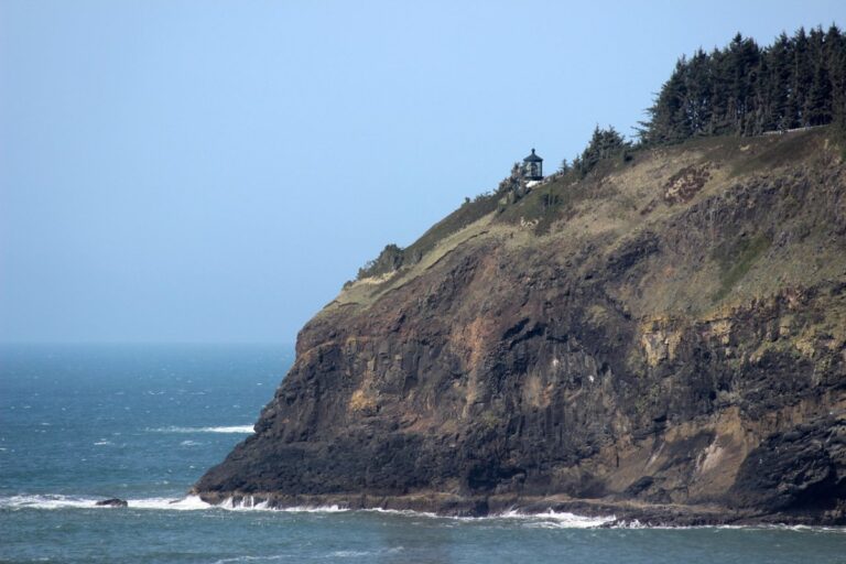
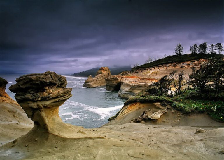
Cape Meares State Scenic Viewpoint and Octopus Tree Trail
Cape Meares State Scenic viewpoint and lighthouse near Oceanside, Oregon / OR Parks and Recreation
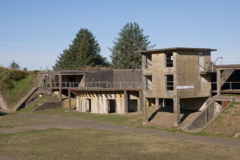
Features: A large recreation area and campground at the site of an old military fort that guarded the mouth of the Columbia River through World War II. There are 15 miles of multi-use trails great for biking and walking, as well as a disc golf course, a lake and a shipwreck on the beach.
Features: Walk through sitka spruce and hemlock forest high above the Pacific Ocean on the way to the tip of Cape Lookout (trail can be muddy year-round).
Update 1/20/2024: The North Trail at Cape Lookout has been closed due to downed trees and damage to the bridge from the recent winter storm.
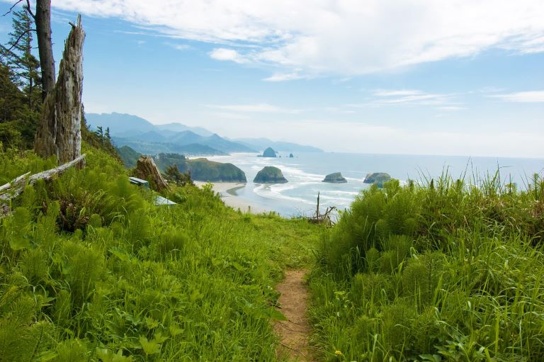
Features: Cliffside viewpoints, secluded coves, coastal forests and views of an abandoned lighthouse on clear days. This is one of the most scenic areas for coastal Oregon hikes with some of the best beach trails and tide pools to explore.
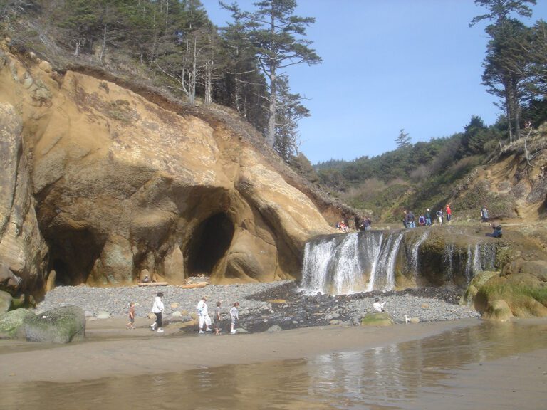
Features: Easy walk to a beach cove where you can see Hug Point waterfall, explore sea caves carved into sandstone cliffs and access tide pools during low tide. Check tide tables before you go (only accessible at low tide). This is a great waterfall near Cannon Beach to explore while you’re staying in the area and isn’t too hard to reach if you time it right.
Features: Oswald West State Park offers 2,484 acres of some of the best coastal Oregon hikes, secluded sandy beaches, surf spots and coastal rainforest. Short Sand Beach Trail (easy), Cape Falcon (moderate) and Neahkahnie Mountain (challenging) are popular hiking trails.
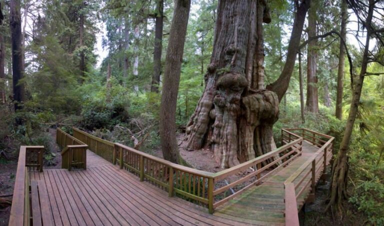
👩🦽Features: Easy 1-mile walk on an elevated wooden boardwalk through old-growth forest wetlands to a giant western red cedar tree. Stroller and wheelchair accessible.
Features: A short but steep beach hike up a sand dune will reward you with scenic views. The sandstone headland here is constantly eroding, forming interesting rock formations that can be viewed from behind a safety fence.
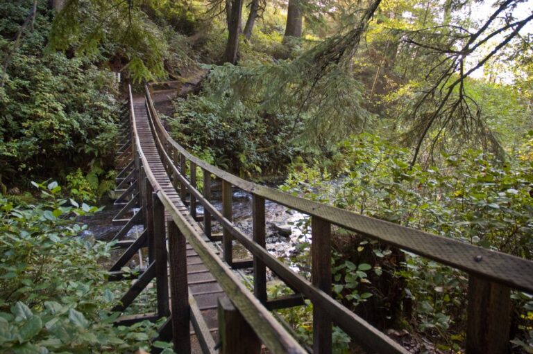
Features: There are miles of gorgeous hiking trails in this vast coastal Oregon national forest area, including waterfalls, creeks, lakes, dunes, mountain summits, ridges and coastline. Drift Creek Falls is a popular hike to a waterfall that includes crossing a suspension bridge.
👉 For more hiking information, including directions, descriptions and trail maps, visit Siuslaw National Forest.
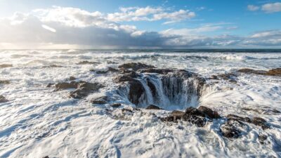
Cape Perpetua Scenic Area
Cape Perpetua Overlook near Yachats, Oregon / Nikky, CC BY 2.0
Features: This strikingly beautiful headland projecting into the Pacific Ocean forms the highest point accessible by car on the entire coast. There are 26 miles of hiking trails in Cape Perpetua Scenic Area featuring old-growth forests, Native American shell middens, the Devil’s Churn, Thor’s Well, tidepools and stunning views. The stone shelter is a fun hike to an old stone structure overlooking the ocean.
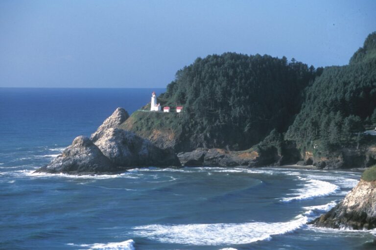
Features: Visit the iconic Heceta Head Lighthouse and explore the Hobbit Trail and the surrounding coastal hiking trail network. Take in spectacular ocean views and spot wildlife, including whales, sea lions and elk.
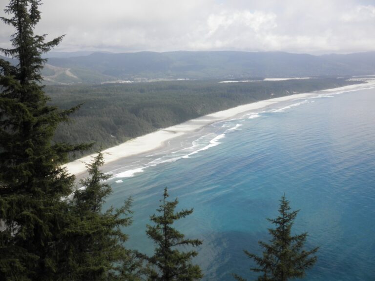
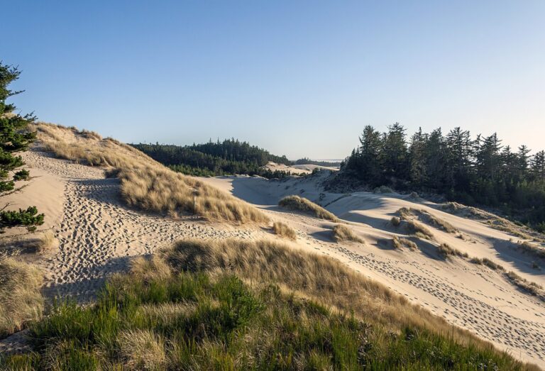
Features: These sandy hiking trails pass through the mystical coastal landscape that inspired the Dune novel and movies. Explore freshwater lakes, coastal forests, tree islands and beach hiking trails that are more challenging than they may appear.
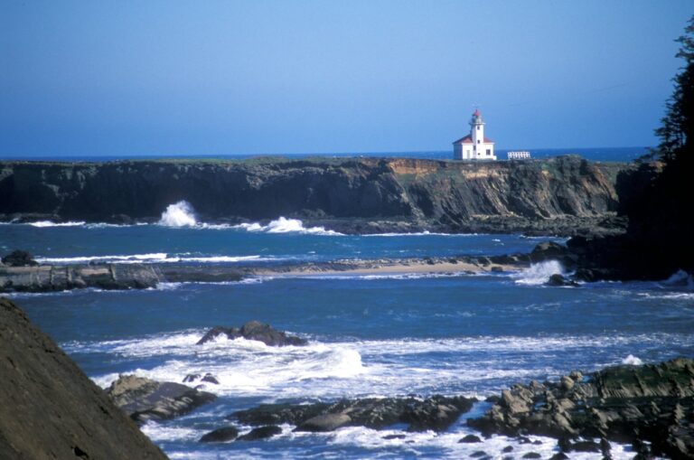
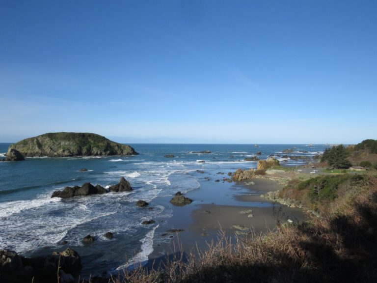
Features: There are many Oregon Coast hikes and scenic beach hiking trails near Coos Bay to explore, especially between Cape Arago and Bastendorff Beach. See the sheer seaside cliffs, big waves and rock formations, a lighthouse, seals, sea lions and tide pools.
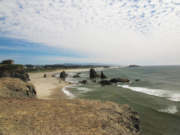
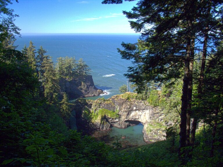
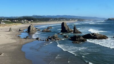
Features: Several trails in this scenic corridor offer some of the best coastal hikes in Oregon leading to dramatic bluffs and rock formations with views of blue-green ocean pools on clear days. It’s one of the most photographed sections of coastline in Oregon and is truly impressive.
Features: Discover Oregon’s more rugged southern coast in this park with several coastal hiking trails, a beach campground and miles of quiet beaches to roam.
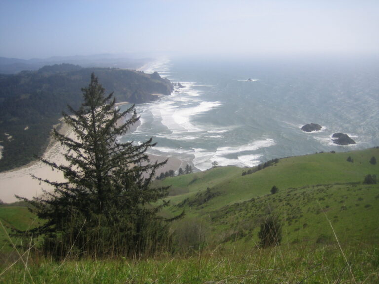
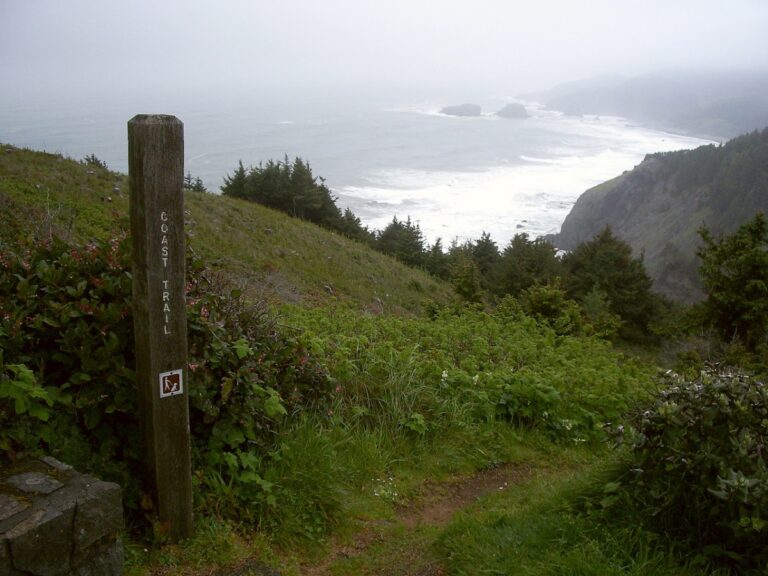
Hiking on the Oregon Coast Trail / EncMstr, CC BY SA 3.0
The Oregon Coast Trail (OCT) is made up of ten trail segments that run the entire 363-mile length of the Oregon Coast through forests, beaches and towns from the Columbia River in the north to the California border in the south.
📍 Get maps of each segment on the Oregon Coast Trail.
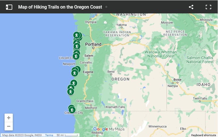
Map of Oregon Coast Hiking Trails
Just click the hiking map below to see more details about each trailhead location.
Oregon Coast hiking trails map of trailhead locations
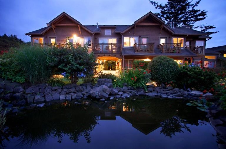
Places to Stay at the Oregon Coast
Hotels and Vacation Rentals
The Inn at Cannon Beach, Oregon Coast / booking.com
Compare prices and book early for the best options and properties to choose from. Hotels on the Oregon Coast tend to fill up in summer, on weekends and during holidays and festivals. Popular towns in the northern coast region near Portland will fill up faster than towns further south.
Our guides to each of the Oregon Coast towns also suggest options for where to stay and list the major annual events to help you plan.
We like Booking.com for its fast, easy-to-use app with mobile-only and “genius” deals on hotels and vacation rentals. Vrbo is also a great place to search for cozy cabins and beach houses.
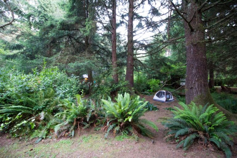
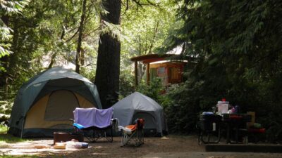
Camping and RV Parks
Tent camping in Sunset Bay State Park near Coos Bay, Oregon / OR Parks and Recreation
Camping is one of our favorite ways to experience the natural beauty of Oregon and many state parks have hiking trails nearby. Oregon has some of the nicest state parks in the country, featuring tent sites, hiker/biker camps, horse camps, group camps, RV sites with full hookups, cozy yurts and deluxe cabins available for rent.
🚐 There are several privately owned RV parks and campgrounds along the Oregon Coast off Highway 101. Services and facilities can vary widely, so be sure to check reviews on Google Maps or use a trusted trip-planning app like RV Life to read unbiased reviews of campgrounds by other RVers Try it free!
Transportation
Driving is the most convenient way to explore the Oregon Coast at your own pace but there are car-free options available. For air, train, bus and rental car information, see Transportation to the Oregon Coast.
🚗 Save up to 70% on your next car rental through DiscoverCars.
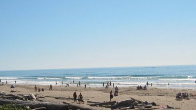
Weather - Best Time for Hiking the Oregon Coast
Weekends, summer months and holidays are the busiest times to visit the Oregon Coast. Trails will likely have more traffic during these peak times and parking lots will fill up, so arrive early in the morning to dodge the crowds, especially if there is warm, sunny weather in the forecast.
Spring, fall and winter hiking means muddy trails and bigger waterfalls. Be prepared for wet, cold and stormy weather. See Oregon Coast Weather – When to Visit for more about the weather in this region of the Pacific Northwest.
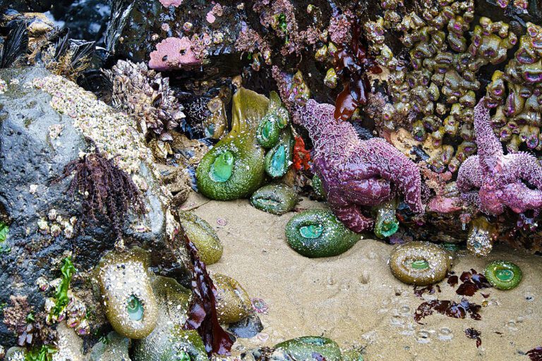
Tide Charts for the Oregon Coast
Haystack Rock tide pools at low tide, Cannon Beach, Oregon / John Manard, CC BY SA
There are two low tides and two high tides every day on Oregon’s coast. Low tide is a good time for beachcombing, tide pools, cave exploration and clamming.
For your safety, be aware of the tide schedule before boating or heading out to beaches and always keep an eye on the water level. Use extreme caution in rocky areas near the water, where sneaker waves can (and do) strike.
Check tide tables or ask at state park offices, local visitor information centers and many stores and hotels for a free tide table booklet.