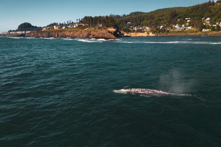
Gray whale off the coast of Depoe Bay / Dan Meyers
At the edge of the rocky coastline, protected by a sea wall that allows the occasional spouting wave to spill over, Depoe Bay is simultaneously the “Whale Watching Capital of the Oregon Coast” and the “Smallest Harbor in the World.”
Find fun things to do in Depoe Bay, Oregon along with the best restaurants, hotels and must-see attractions as you explore this beautiful section of the central Oregon Coast.
This page may contain affiliate links where we earn a small commission at no cost to you. As an Amazon Associate, we earn from qualifying purchases. Our suggestions are based on our own experience and thorough research. Full disclosure.
Depoe Bay is located on the central Oregon Coast in Lincoln County, about 2.5 hours driving from Portland (102 miles). Take highway 18 west through Willamette Valley wine country to the highway 101 south junction at Otis. Highway 101 south will take you through Lincoln City to Depoe Bay.
Driving is the easiest and fastest way to get to Depoe Bay. For air, bus, train, car and camper rental information, see Transportation to the Oregon Coast.
🚗 Save up to 70% on your next car rental through DiscoverCars.
About Depoe Bay
Depoe Bay was named after Charles DePoe or “Depot Charlie,” a member of the Tututni-Joshua tribe who was relocated to the Siletz reservation in the late 1800s along with many other natives who had survived smallpox and the arrival of white settlers. For more about Oregon native history in this area, see the Confederated Tribes of Siletz Indians.
DePoe was originally allotted the land in 1894 and the town was purchased from the family in the 1920s. Eventually, real estate investors purchased the land with plans to develop it into a tourist town. Today, Depoe Bay has a population of about 1,400 residents.
Top Things to Do in Depoe Bay, Oregon
Watch for Whale Tails
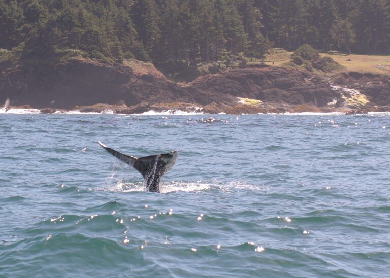
Gray whale off the coast of Depoe Bay / ODFW
As the whale watching capital of the Oregon Coast, Depoe Bay is the best place to see gray whales year-round.
What Are the Best Months to See Whales at the Oregon Coast?
In winter, gray whales migrate south to Mexico from mid-December to mid-January. Then in spring, they make their way back north to Alaska accompanied by their new calves.
During summer and fall a resident pod of gray whales can be seen regularly feeding close to shore.
How to Spot Whales in Depoe Bay
Scan the surface of the water and you may spot their signature puffs, little clouds of mist that rise up into the air. Keep watching and you may see a head or tail pop up, and if you’re lucky you could see a full breach.
The Whale Watching Center is located right next to the harbor entrance in Depoe Bay and is a great place to learn more about whales. Trained volunteers and binoculars are available to help visitors spot whales during the winter and spring migrations.
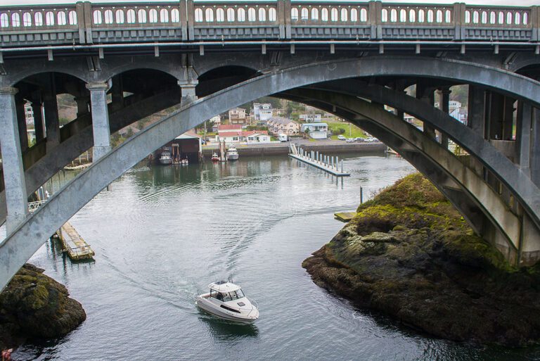
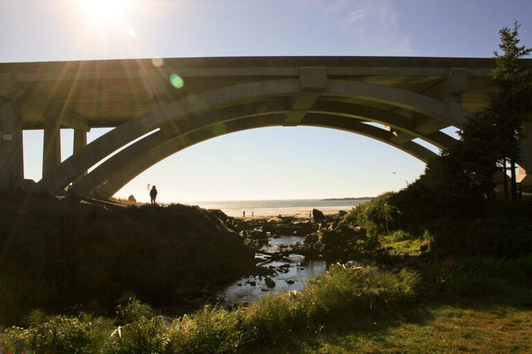
Depoe Bay Bridge and harbor entrance / CC BY-SA 3.0
Depoe Bay, Oregon boasts the world’s smallest natural navigable harbor, where charter boats leave for a day of fishing for fresh halibut, tuna, lingcod or crab. Whale watching tours also depart daily for up-close encounters.
Watch the boats navigate through the 50-foot-wide channel and under the arches of Depoe Bay Bridge as they leave and return for the day. The fishing scene from the 1975 movie, One Flew Over the Cuckoo’s Nest was filmed right here in Depoe Bay harbor.
Watch Out for Spouting Horns
A protective sea wall runs the length of the town but watch out– you might get sprayed! During high tides, king tides and storms, the natural spouting horns in Depoe Bay will spray sea water high above Highway 101, drenching cars and unsuspecting onlookers (park in the public parking lot off the highway if you don’t want your car to get sprayed).
The waves can be viewed from many points along the rocky shoreline around Depoe Bay, but please use caution, keep your distance and heed warning signs and safety barriers. Don’t go in for a closer look, even if you see other people doing it. Sneaker waves are deadly and can strike out of nowhere.
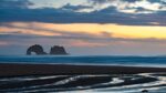
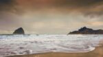
Take in the Views on the Otter Crest Loop
Rocky Creek State Scenic Viewpoint / OR Parks and Recreation
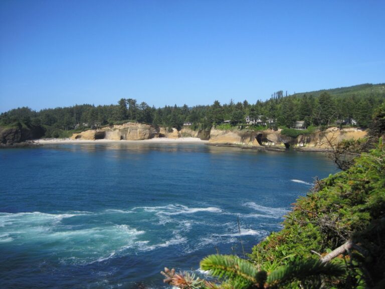
Rocky Creek State Scenic Viewpoint
One of the best things to do near Depoe Bay is explore all of the scenic coastal viewpoints within minutes of town. Drive south from Depoe Bay on highway 101 for about 2 miles and you’ll reach Rocky Creek State Scenic Viewpoint, a nice place to stop and spot whales and enjoy the views. There’s an open grassy area, picnic tables, restrooms and a short walk north will take you to the viewing deck of Whale Cove Vista Point.
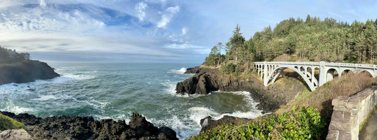
Ben Jones Bridge at Rocky Creek / ODOT
Ben Jones Bridge to Cape Foulweather
Keep heading south on the highway for about 1 minute and pull off at Rodea Point, another scenic viewpoint. From there, take the Otter Crest Loop road, a one-way road going south.
At Rocky Creek Falls/Ben Jones Bridge, there is a small pullout where you can look back at the bridge (designed by Conde B. McCullough) and enjoy the view. The road then climbs up 500-foot Cape Foulweather, the first Oregon land formation seen by Captain James Cook in 1778.
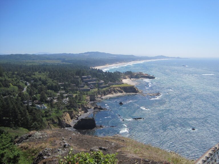
Otter Crest State Scenic Viewpoint south of Depoe Bay, Oregon / OR Parks and Recreation
You’ll arrive at Otter Crest State Scenic Viewpoint, one of the best viewpoints along the entire Oregon coast. Bring binoculars for spotting sea lions, whales and other sea life.
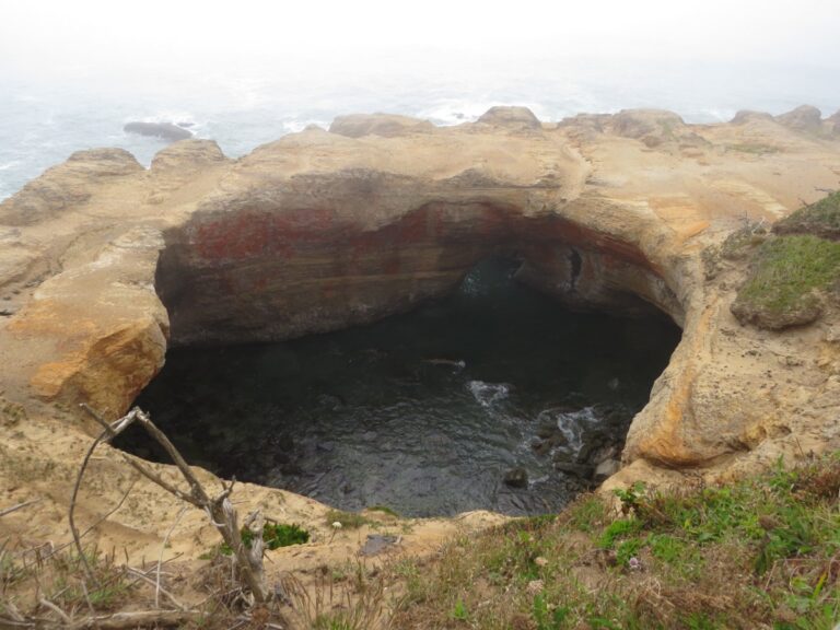
Devil's Punchbowl, south of Depoe Bay, Oregon / OR Parks and Recreation
Devil's Punchbowl State Natural Area
Devil’s Punchbowl State Natural Area is just 2 more miles to the south. A hollowed-out bowl-shaped rock formation, the punchbowl was likely created by the collapse of two sea caves.
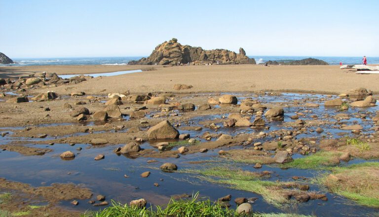
It’s a popular spot to watch the waves as they swish and swirl into the bowl, especially during king tides and winter storms. There are also tide pools along the north side of Devil’s Punchbowl, as well as Otter Crest Beach and Otter Rock Beach. See our Oregon Coast tide pools guide for more locations.
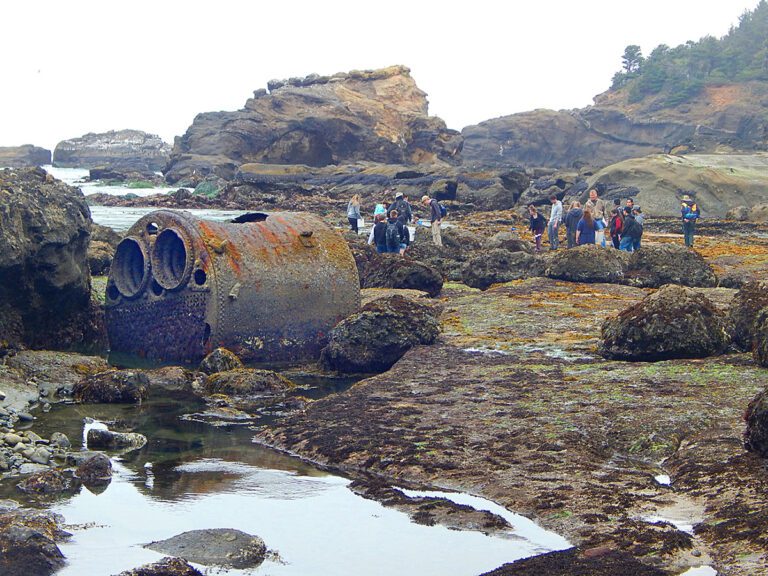
Spot a Shipwreck in Boiler Bay
Boiler from the J. Marhoffer shipwreck at Boiler Bay, near Depoe Bay, Oregon / Cecille Engle Kennedy, CC BY-SA 4.0
Five minutes north of Depoe Bay, Boiler Bay State Scenic Viewpoint is a great place to pull over, take in the views and spot whales and seabirds. In 1910, a steamship called the J. Marhoffer accidently caught on fire, crashed into the rocks and exploded here.
You can sometimes see the ship’s big boiler still sitting where it landed 100 years ago and during extreme low tides, some have even ventured out to it. The site, formerly known as Briggs Landing, was renamed Boiler Bay after the shipwreck. Learn more about shipwrecks on the Oregon Coast.
Fogarty Creek State Recreation Area near Depoe Bay, Oregon / Ian Poellet, CC BY-SA 3.0
Beverly Beach State Park by Celeste Ramsay, CC-2.0
Beverly Beach State Park day-use area AND campground will be closed to upgrade the power and water lines until July 1, 2024. The next state park down the coast is South Beach State Park, 25 minutes south in Newport.
🚐 There are several privately owned RV parks and campgrounds along the Oregon Coast off Highway 101. Services and facilities can vary widely, so be sure to check reviews on Google Maps or use a trusted trip-planning app like RV Life to read unbiased reviews of campgrounds by other RVers. Try it free!
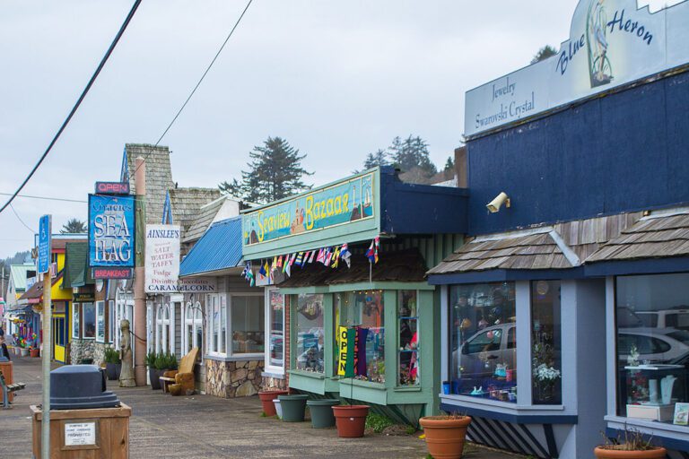
Restaurants and Dining in Depoe Bay
Restaurants in Depoe Bay / visitor7, CC BY-SA 3.0
Most of the restaurants in Depoe Bay are located right along highway 101.
Tidal Raves Seafood Grill offers outstanding views of the ocean, fresh seafood, steaks, pasta and fish dishes.
Gracie’s Sea Hag has been a beloved local seafood spot since 1963 and is known for their clam chowder. They also serve hearty breakfasts.
Bay View Thai Kitchen is a family-owned casual spot on the harbor serving warm and spicy curry, noodle and rice dishes plus Thai specialties like seafood curry served in a young coconut.
For upscale fine dining with a gorgeous view of Whale Cove, Restaurant Beck at the luxurious Whale Cove Inn serves locally sourced seafood with fresh ingredients from local farms.
The weather in Depoe Bay is generally cool (50s-60s F) and damp with frequent rain throughout the year, with the exception of July and August. Temperatures rarely get too hot in summer with highs in the 60s-70s. Lows dip down into the 30s in winter but snow is rare. Spring and Autumn are a mix of sunny and rainy days.
Not sure what to pack for your trip to the Oregon Coast? The beaches are usually breezy and cool. It’s a good idea to wear layers and bring rain gear. See our guide on what to wear to the Oregon Coast for a free downloadable packing list and more details.
There are two low tides and two high tides every day on Oregon’s coast. Low tide is the time for beachcombing, clamming, tide pools and cave exploration.
For your safety, be aware of the tide schedule before boating or heading out to beaches and always keep an eye on the water level. Use extreme caution in rocky areas near the water, where sneaker waves can (and do) strike.
Check tide tables or ask at state park offices, local visitor information centers and many stores and hotels for a free tide table booklet.
Taking a road trip? From Depoe Bay, drive 20 minutes north to Lincoln City, or head 20 minutes south to Newport to continue exploring Oregon Coast towns.
Feel free to bookmark this page or pin it for future reference!

